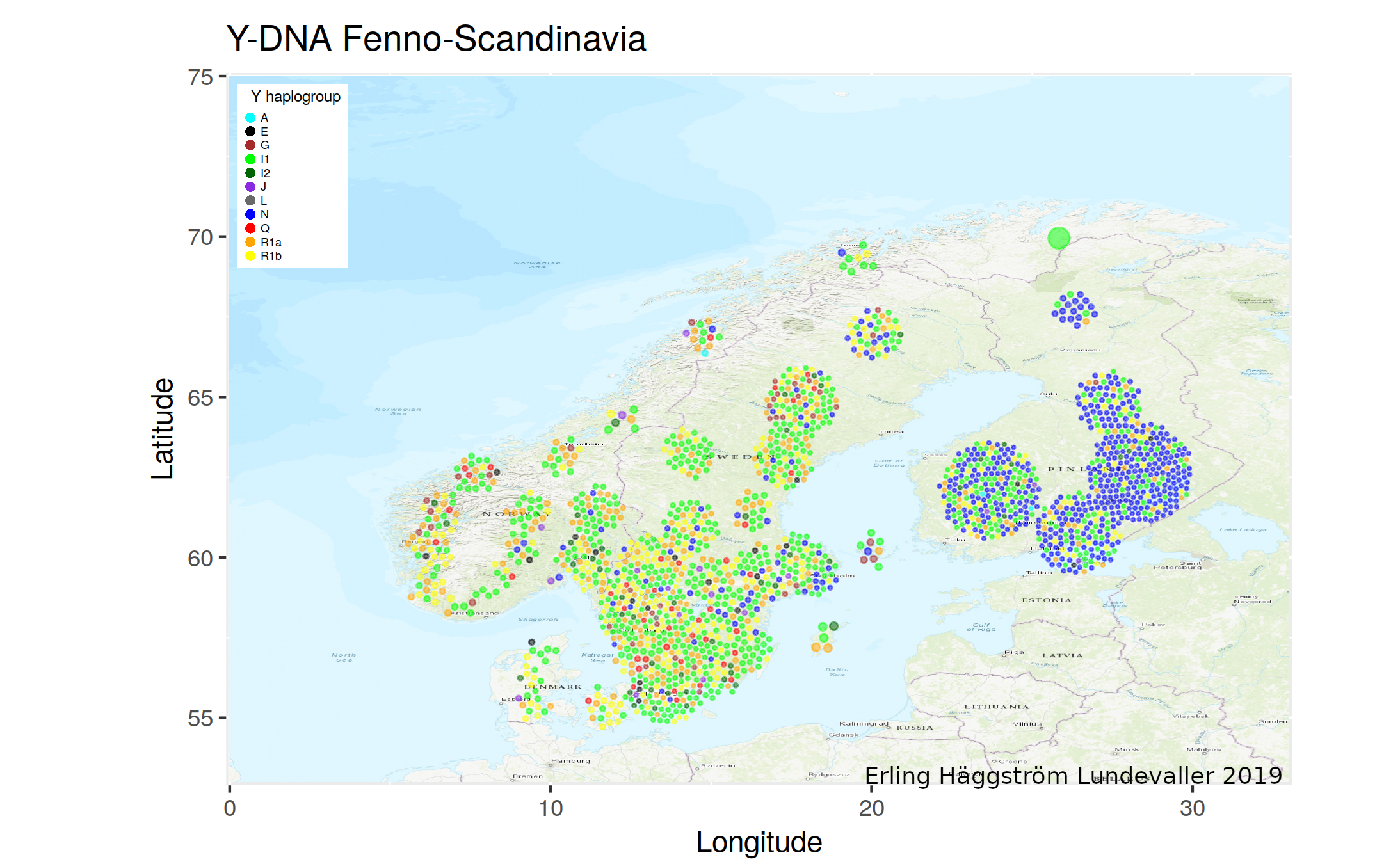
I made a map of the YFull kits with province listed for the Scandinavian countries and Finland with the basic idear that one kit should be one point. Mainly as an experimental alternative to other maps for showing the geographical distributions of the haplogroups. To avoid over plotting each point searches for a free space to be plotted and can also adjust size to squese in. This causes the ball shapes in especially Finland as most points are located to province landmass centroides. So, the data is not optimal for this method as some points get ploted some distance from the actual location but can give a rough overview of the distribution. Interesting A1a in Nordland and western Finland and an L in Västra Götaland.
| A | E | G | I | J | L | N | Q | R | |
|---|---|---|---|---|---|---|---|---|---|
| 3 | 21 | 40 | 761 | 17 | 1 | 503 | 42 | 544 |
